
: GUIDE INFO :
- About Us
- Contact Us
- Social Media
- F.A.Q
- Plans
- Albums
- News & Events
- Get A Website
- Marketing Tips
- Useful Links
- International Links
: HOTELS DIRECTORY :
- Beirut Hotels
- Bekaa Hotels
- Mount Lebanon Hotels
- North Lebanon Hotels
- South Lebanon Hotels
: LEBANON INFO :
- Transportation In Lebanon
- Touristic Sites
- Featured Resorts
- Resorts>
- Grottos
- Embassies in Lebanon
- Photo Gallery
- Articles About Lebanon
- Songs About Lebanon
: SISTER SITES :
- AtLebanon Directory
- Advertise Lebanon
- Professional Innovations
- Lebanon Auto Guide
- Bcharre Chalet & Motel
: GOOGLE ADS :
|
» BEKAA VALLEY LEBANON
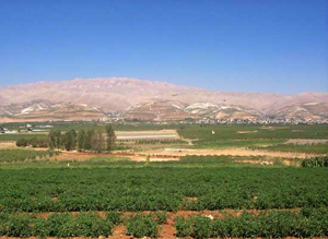
Bekaa is a fertile valley in east Lebanon. The Romans considered the Bekaa Valley to be a major agricultural source, and today it remains Lebanon's most important farming region, and a major Shia population center in Lebanon.
Geography  The Bekaa is a fertile valley in Lebanon, located about 30 km east of Beirut. The valley is situated between the Mount Lebanon to the west and the Anti-Lebanon mountain ranges to the east. It forms the north eastern most extension of the Great Rift Valley, which stretches from Syria through the Red Sea into Africa. Bekaa Valley is about 120 km in length and has an average width of about 16 km. From the 1st century BC, when the region was part of the Roman Empire, the Bekaa Valley served as a source of grain for the Roman provinces of the Levant. The Bekaa is a fertile valley in Lebanon, located about 30 km east of Beirut. The valley is situated between the Mount Lebanon to the west and the Anti-Lebanon mountain ranges to the east. It forms the north eastern most extension of the Great Rift Valley, which stretches from Syria through the Red Sea into Africa. Bekaa Valley is about 120 km in length and has an average width of about 16 km. From the 1st century BC, when the region was part of the Roman Empire, the Bekaa Valley served as a source of grain for the Roman provinces of the Levant.
Today the valley makes up 40 percent of Lebanon's arable land. The northern end of the valley, with its scarce rainfall and less fertile soils, is used primarily as grazing land by pastoral nomads, mostly migrants from the Syrian Desert. Farther south, more fertile soils support crops of wheat, corn, cotton, and vegetables, with vineyards and orchards centered around Zahle. Since 1957 the Litani hydroelectricity project-a series of canals and a dam located at Lake Qaraoun in the southern end of the valley-has improved irrigation to farms in Bekaa Valley. Districts and towns Zahle is the largest city and the administrative capital of the Bekaa Governorate. It lies just north of the main Beirut-Damascus highway, which bisects the valley. The majority of Zahle's residents are Lebanese Christian, including those belonging to the Armenian Apostolic Church, Melkite Greek Catholic Church, Maronite Church, and members of the Greek Orthodox Church. The town of Anjar, situated in the eastern part of the valley, has a predominately Armenian Lebanese population and is also famous for its 8th-century Arab ruins.
The majority of the inhabitants of the northern districts of Bekaa, Baalbek and Hermel, are Lebanese Shia & Sunni, with the exception of the town of Deir el Ahmar, whose inhabitants are Christians. The western and southern districts of the valley have a mixed population of majority Sunni, Christian, and Druze Lebanese. The town of Jib Janine with a population of about 9,000, is situated midway in the valley, and its population is Sunni.
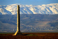
Landmarks  Bekaa is also rich in archaeology and history has left some of its most famous monuments scattered all over this region.
. The Aammiq Wetland habitat for a myriad of migrating and resident birds and butterflies . The Umayyad ruins of Anjar - An archaeological site excavated 40 years ago and one of the few surviving ruins of the 8th century Umayyad period. Anjar was a hunting grounds and a resort for the traveling princes of the period. Still intact are the city's walls and gates surrounding the twin palaces of the Caliph. The remains of 600 shops indicate that Anjar was also an important trading centre that drew traders from all corners of the land. Arcades, engravings and symbols show the Roman-Byzantine influence on the Umayyad architecture. . The ancient Roman ruins of Baalbek, an ancient city named for the Canaanite god Baal. The Romans renamed Baalbek "Heliopolis" and built an impressive temple complex, including temples to Bacchus, Jupiter, Venus, and the Sun. A new temple has been discovered in 1995 and is being excavated and an Umayyad mosque still stands in the city centre. Today, the ruins are the site of the Baalbek International Festival, which attracts artists and performance groups from around the world.. The Sanctuary of Our Lady of Bechouat .Hermel has two interesting sites: o A pyramid believed to be the tomb chamber of a Syrian prince around the 2nd century BC, o The monastery of St. Maroun which is a grotto carved in the mountain rocks. .Zahle was once called "The Bride of the Bekaa" because of its natural beauty and marvelous scenery. Located on the banks of the Bardouni River where there are many riverside restaurants famous for their cuisine. . Our Lady of Bekaa, a Marian shrine located in Zahle, with panoramic views of the valley. . Roman Ruins, located in the town of Kab Elias . Phoenician Ruins, located in the village of Kamid El-Lowz . Lebanon's tallest minaret, located in the town of Kherbet Rouha Wines The Bekaa Valley is Lebanon's most important farming region. It is also home to its famous vineyards and wineries. Wine making is a tradition that goes back 6000 years in Lebanon. With an average altitude of 1000 m above sea level, the valley's climate is very suitable to vineyards. Abundant winter rain and much sunshine in the summer helps the grapes ripen easily. There are more than a dozen wineries in the Bekaa Valley, producing over six million bottles a year.. Château Ksara . Château Musar . Château Kefraya |
|


 Lebanon Auto Guide
Post,Buy your car.
 Chalets & Loding Rooms
One of Besharry/Al-Arz Tourists Destination